
___________________________________________________________________________________________________
The Mount Hypipamee Crater on the Atherton Tablelands.
From Wikipedia, the free encyclopedia
The Mount Hypipamee Crater, also known as The Crater is a huge diatreme located south-east of Herberton on the Atherton Tableland in Far North Queensland, Australia. It is 61 metres in diameter and 82 metres deep.
It was first discovered by accident when in 1879 Weate and party nearly fell into it. They were heading towards the Mulgrave River on a five-month gold prospecting expedition.
The national park was established in 1908 under the sponsorship of a Mr. Ringrose of Herberton. There was a debate at the “crater trust” meetings during the 1930s as to what to call “the crater”, the “Herberton Crater” was one suggestion but it was decided to call it the traditional Dyrbal name, Mount Hypipamee. A request was written to Ernest Gribble of Palm Island to find the origin of the name. The name Hypipamee is a corruption of the Aboriginal word, nabbanabbamee, which is connected with a legend of two young men who cut down a sacred candlenut tree, only to be swallowed up by a large hole in the earth, the crater.
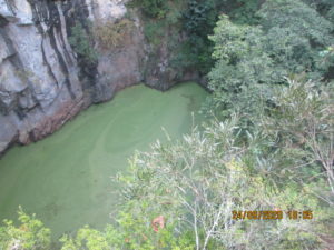
The water surface is covered with duck weed. Dinner Falls at the head of the upper Barron River gorge is also part of this park.
It was once thought that “The Crater”, Lake Eacham and Lake Barrine were all connected underground with water tunnels, but this is incorrect. Local legend once said that an aboriginal woman once fell over the side into the crater and later surfaced in Lake Eacham.
____________________________________________________________________________________________________
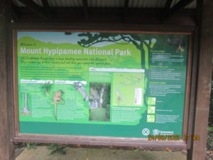
The sign for telling details on the Crater.
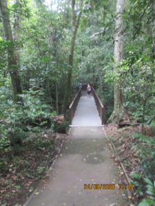
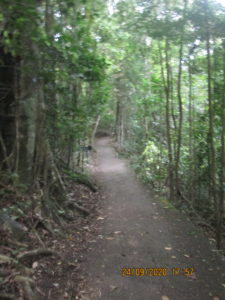
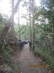
A path into the Crater Lake leads to a little bridge over a creek.
Harriet was reading this sign and Keiron came quietly up to her and whispered how there was a live Cassowary in the bush behind her. The bird had moved by the time I got there. The bird below is a model of the bird.
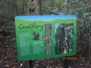
The sign says: The lumps and bumps on the tree are called cauliflora. The fruit and flowers grow from the tree trunk and older branches instead of higher up in the canopy like most other species. This alternative production strategy may attract a greater number of pollinators and seed disperses. Exposure in the middle of the forest can entice animals from their usual feeding zones – either down from the canopy or up from the forest bottom.
THE BATTY ADVANTAGE: Many north Queensland fruit-eating bats (flying foxes) pollinate cauliflorus plant species. Having flowers and fruit located away from wing-tangling branches is an obvious benefit to bats which are pollinators and seed disperses of rainforest plants.
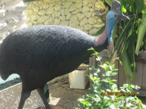
The bird above is a model of the Cassowary.

The lumps and bumps on the tree are called cauliflora.

The sign which says: World Heritage Rainforest and World Heritage Reef. A journey of the Barron River.
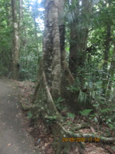
More rainforest trees …. this one a Moreton Bay Fig with its spreading buttress root.
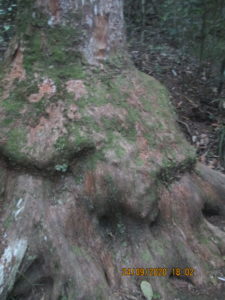
A large spreading buttress root of a Eucalypt tree.
Approaching the viewing deck over the Crater Lake.
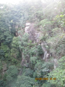
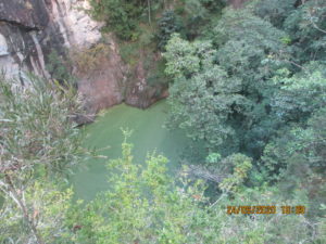
The cliffs plunge vertically into the Crater Lake.
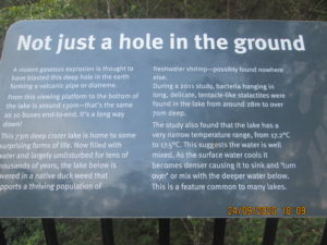
This 73-metre deep crater lake is home to some surprising forms of life. Now filled with water and largely undisturbed for many years, the lake below is covered by a native duckweed that supports a thriving population of freshwater shrimps, possibly found nowhere else.
During the 2011 study (see notes below on ‘Not Just A Hole In The Ground’), bacteria hanging in long, delicate, tentacle-like stalactites were found in the lake around 28 metres to 70 metres deep. The study also found that the lake has a very narrow temperature range from 17.2 degrees centigrade to 17.5 degrees centigrade. This suggests the water is well mixed as the surface water cools, it becomes denser, causing it to sink and turn over and mix with deeper water below. This is a feature common to many lakes.
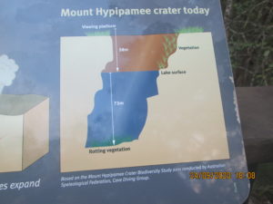
The sign says that the crater lake is 58 meters down below the viewing deck and the crater lake is 73 metres deep. This information is based on the Mount Hypipamee Crater Biodiversity Study 2011 conducted by the Australian Speological Federation, Cave Diving Group.
A violent gaseous explosion is thought to have blasted a deep hole in the earth forming a volcanic pipe or diatreme.
From the viewing platform to the bottom of the lake is around 130 metres – that’s the same as 10 buses end to end. It’s a long way down!
This 73-metre deep crater lake is home to some surprising forms of life. Now filled with water and largely undisturbed for many years, the lake below is covered by a native duckweed that supports a thriving population of freshwater shrimps, possibly found nowhere else.
During the 2011 study, bacteria hanging in long, delicate, tentacle-like stalactites were found in the lake around 28 metres to 70 metres deep. The study also found that the lake has a very narrow temperature range from 17.2 degrees centigrade to 17.5 degrees centigrade. This suggests the water is well mixed as the surface water cools, it becomes denser, causing it to sink and turn over and mix with deeper water below. This is a feature common to many lakes.
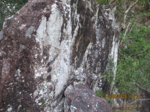
The vertical cliffs into the crater lake,
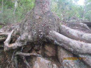
Going out from the crater along the path …. a big eucalypt tree has grown big roots that have endeavoured to hold the tree up on the side of the path.
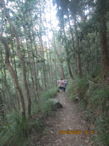
Walking along the path to go back to the parking lot.
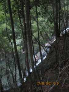
Looking down over the path we were on and seeing a creek tumbling down a waterfall.
_____________________________________________________________________________________________________
To see the next activity we were involved with over the week we were up on the Atherton Tablelands, see this post:
Post 5: Trip on the Daintree River to look at crocodiles … Atherton Tablelands
__________________________________________________________________________________________________