
___________________________________________________________________________
Note: I would like to share with you through these few words, photographs and hyperlinked websites, a 3 Dimensional experience as though you were actually there with us. Click on any photograph and it should enlarge to a different size ….. at least half screen or size full screen. It will be clearer in detail than the photo on the post. It will be as if you were really there looking at the actual scene. You are an arm chair traveller with us.
If you would also like to see the post in a larger or smaller size, I suggest you follow this procedure: If you right-handed, with your left hand, press down continuously on the Control Function Key with your left hand and with your right hand, move the little cursor wheel either forwards or backwards to make the text in the post larger or smaller.
____________________________________________________________________________
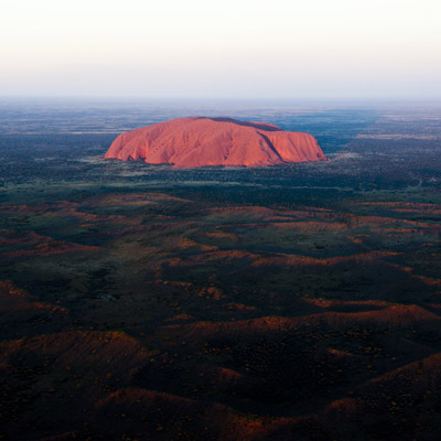
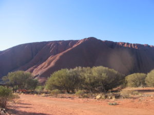
Uluru National Park is the home of Ayers Rock, a huge monolith in the centre of Australia.
The park also contains the nearby Olgas (or Kata Tjuta), but, as far as Australian national parks go, it is a relatively small at only 70kms wide. The park was set up to protect the monolith, which retains the Aboriginal name of ‘Uluru’.
Alice Springs is the nearest main town to Uluru National Park, about 460kms by road from the northern entrance. The expanse sits in the southwest of the Northern Territory and is served by the Red Centre Highway (4), which first goes through the service town of Yulara, where all the accommodation and facilities for visitors to the park are best.
Uluru National Park is a UNESCO World Heritage site and is considered sacred by the Aborigines, who were in the area 10,000 years ago. The land was given back the ‘Anangu’ Aborigines after being occupied white settlers, although it is now leased to the Australian government and co-managed. Although Ayers Rock is open to all (A$25 for a three-day pass) and visitors can climb the rock, the Aboriginals try to discourage this activity as they see it as disrespectful to their ancestors.
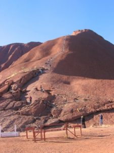
Visitors should also take note of any ‘No Photography’ signs, although the rule is generally not enforced. Parts of the park are off-limits to tourists, but they can walk right around Uluru as well as up to the summit. The climb to the steel can, which marks the top of the rock, takes about two hours return, although very fit people may make it to the top in just 20 minutes.
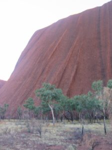
There are a couple of main viewing areas in Uluru National Park; one to the west of the rock (for sunset) and the other to the east (for sunrise). The Olgas are another 35kms to the west of Uluru and are also worth a look.
________________________________________________________________________________________
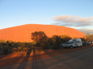
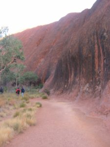
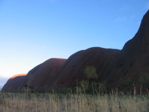
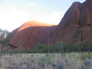
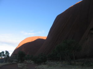
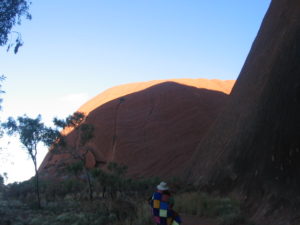
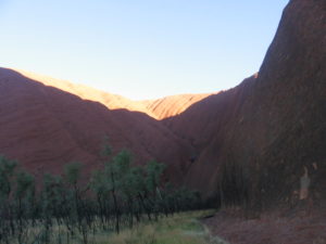
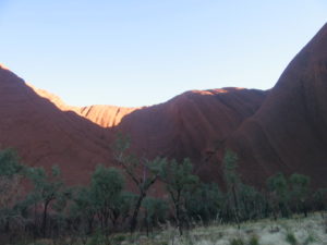
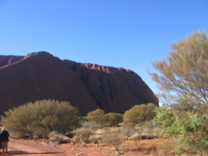
1. Sunrise & Sunset: We went by bus to look at Ayres Rock (Uluru) at sunrise (about 4 degrees in temperature). It is winter time in Australia in June.
The Uluru carpark ….
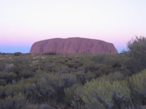
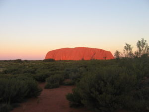
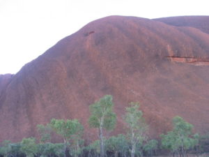
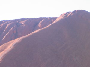
Uluru initially in the predawn, then Uluru with the sun on it ….. Watching the colours change over this amazing landscape is a breathtaking experience. There are two special viewing areas to see Uluru at either dawn or dusk.
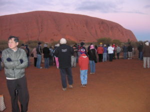
People who have also come to to see the sunrise on Uluru ….
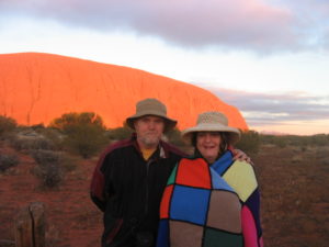
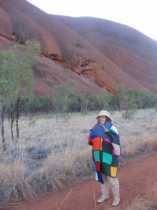
Ken and Harriet Aitken in June 2006. This photograph is at sunrise (about 4 degrees in temperature).
The Olgas are thirty five kilometres away on the horizon.
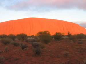
Uluru after the sun has come up …..
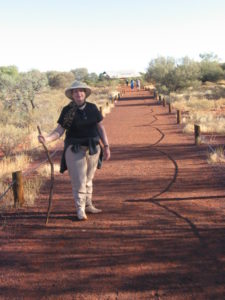
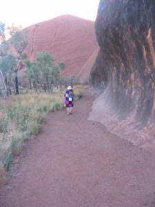
Harriet my wife, walking back to the Uluru carpark ….
See the website: Sunrise and sunset at Uluru
________________________________________________
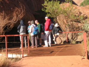
2. Short Walk:
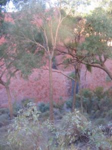
Experiences at Uluru + Kata Tjuta ….
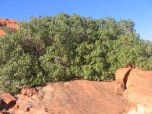
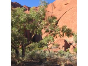
Most visitors would have seen photos featuring Uluru, but nothing prepares you for the experience of being exposed to this expansive living cultural landscape. Experience many wonderful features of this region, including Uluru or Ayers Rock, and Kata Tjuta, also known as the Olgas.
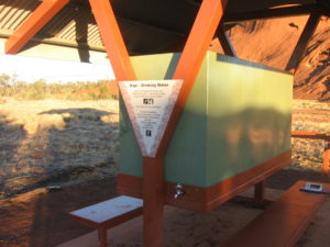
Tank water for drinking … it very precious in this desert area as it has to be transported into this tank …
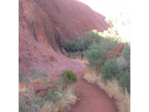
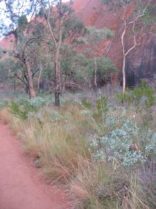
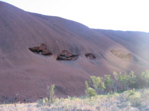
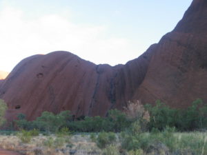
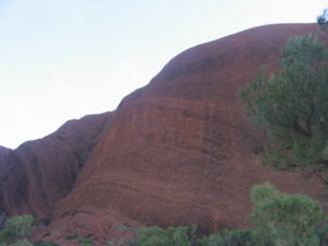
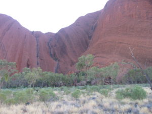
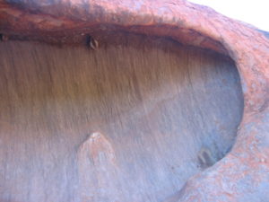
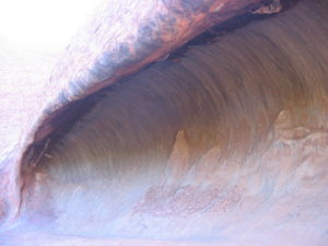
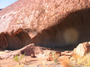
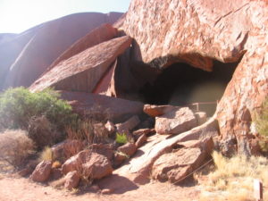
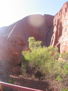
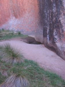
Walking around Uluru:
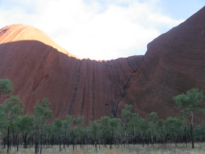
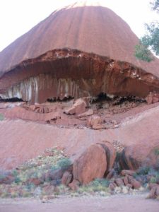
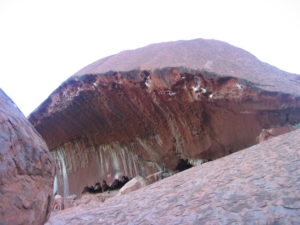
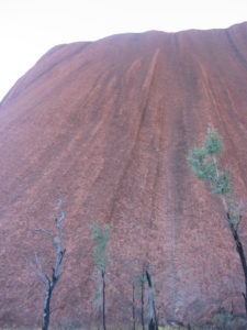
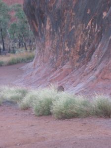

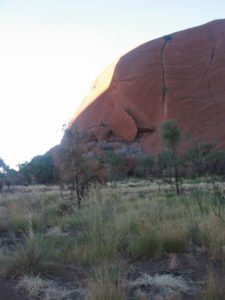
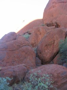
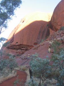
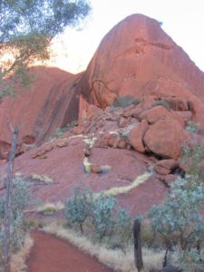
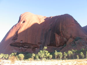
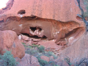
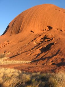
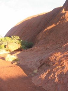
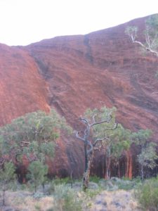
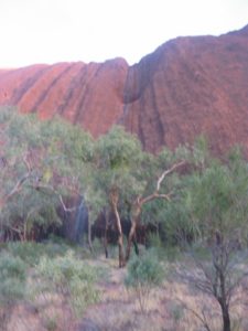
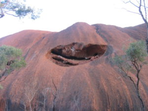
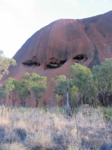
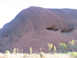
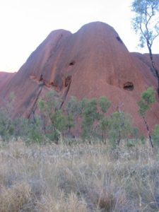
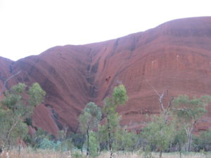
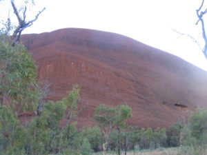
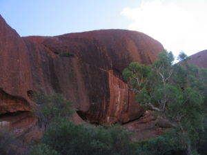
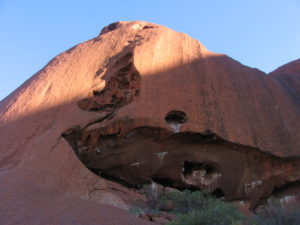
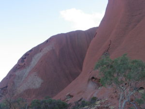
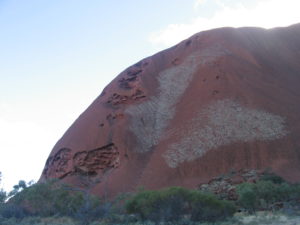
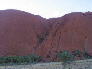
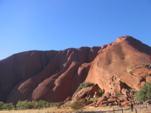
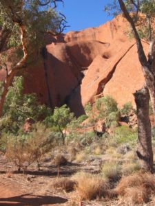
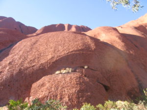
The surface is made up of valleys, ridges, caves and weird shapes that were created by erosion …..
See this website: Images for uluru
________________________________________________
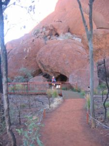
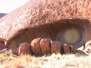
3. Mala Walk:
Learn where the Mala (rufous hare-wallaby) people camped when they first arrived at Uluru. The Mala people are the ancestral beings of Anangu. There are examples of Anangu rock art along this walk and you can experience the sheer vertical walls and profound peacefulness of Kantju Gorge. A great sunset location in winter.
See more at: http://www.parksaustralia.gov.au/uluru/do/bush-walking.html#sthash.NSZvfccE.dpuf
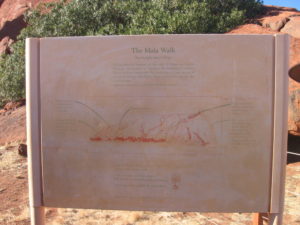
The Mala Walk sign …. A bit hard to read off the website post here but it a better read
if you place your cursor over the photo and you go to ‘View Image’ …..
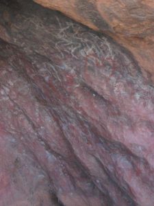
Aboriginal Uluru Dreamtime Story
For the Aboriginal people of Australia, Dreamtime represents the essence of their society, culture, traditions and spirituality. It is a time when ancestors, gods and living mortals come together to learn about the heritage and customs of the Aboriginal people. Dreamtime is the core of everything, and of the many sacred sites in Australia, few are as important as Uluru.
Also known as Ayers Rock, Uluru is believed to have been created at the beginning of time by 10 ancestors, or spirit people, of the Aboriginal people. Tours of Ayers Rock emphasise this connection with the beginnings of the local Anangu Aboriginal people while also highlighting the natural power of the sandstone monolith.
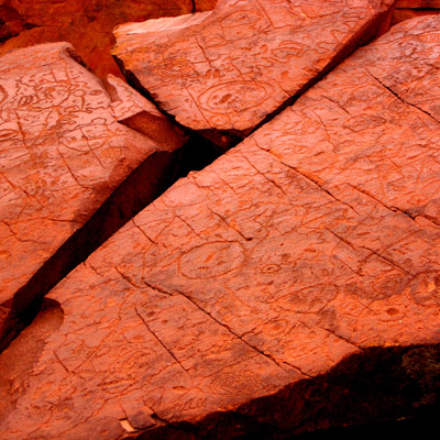
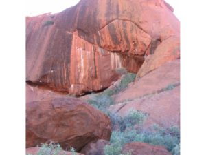
Ayers Rock tours incorporate the amazing rock paintings of the Anangu, the local Aborigine tribe who inhabited this area. The rock paintings are seen as a record of the very period of dreamtime. The rock’s caves, cliffs and fissures contain countless petroglyphs that tell the story of the ancestors. Certain rock outcroppings represent ancestral spirits, and the Anangu believe that by simply touching the rocks they can communicate with dreamtime and receive blessings from their ancestors …….
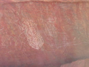
Uluru remains sacred to a number of Aboriginal tribes in the region who still perform rituals in the caves and make new rock paintings. It is worth signing up for a quality tour at Ayers Rock that can show you some of the more unique and special paintings. Each side of Uluru has a different creation story associated with it, and with an experienced local guide you can hear all of the incredible colourful tales that form the basis of Aboriginal culture in this important part of Australia.
Symbols: These are some of the symbols you may see in our rock art and their meanings. They have been passed down generation to generation for thousands of years. We still use these symbols in our modern artwork today.
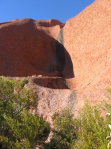
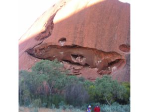
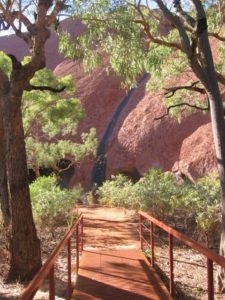
A very precious waterhole at the base of Uluru ……. A bigger pool which we didn’t see is the Mutitjulu waterhole. See this from this website.
_________________________________________
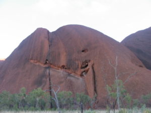
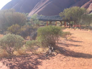
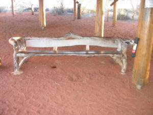
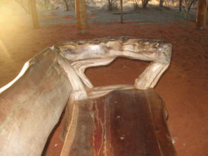
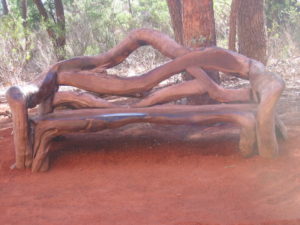
4. 4. Seats & Structures:
______________________________________________________________________________________________
Uluru Facts
Uluru is probably Australia’s best-known natural landmark. The ancient monolith is pretty impressive close up and boasts intriguing statistics. Here are some facts on Uluru:
- FACT: Uluru is better known as Ayers Rock; it named by William Gosse in 1873 after Sir Henry Ayers. Uluru is the Aboriginal and official name.
- FACT: The rock was created over some 600 million years, and the Aborigines have been in the area for the last 10,000 years. It originally sat at the bottom of a sea, but today stands 348m above ground. One of the most startling Uluru facts however, is that some 2.5kms of its bulk is underground.
- FACT: Uluru lies west of the Simpson Desert, not far from the ‘Red Centre’ of Australia, about 335kms southwest of Alice Springs (as the crow flies) and 463kms by road. Contrary to popular belief, it isn’t the biggest monolith in the world; Mount Augustus in Western Australia holds that title
More Uluru Facts
- FACT: Other Uluru Facts: the rock is about 3.6kms long and 1.9kms wide, with a circumference of 9.4kms. The climb to the top is 1.6kms, much of which is at a steep angle, while the summit is generally flat. The surface is made up of valleys, ridges, caves and weird shapes that were created through erosion over millions of years. Surface oxidation of its iron content gives the would-be grey Uluru a striking orange-red hue.
- FACT: The nearby Kata Tjuta (or Olgas) are said to originate from a similar time. They are thought to have originally been one massive monolith, as opposed to the 36 separate domes they are today – one of the lesser known Uluru facts. They are a part of Uluru-Kata Tjuta National Park, which was founded in 1950 as ‘Ayers Rock-Mount Olga National Park’, changing to its current title in 1995. The Aboriginals own the land, although the Australian government currently holds a 99-year lease.
How big is Uluru?
Uluru…
- is 348 metres (1141 feet) high
- rises 863 metres (2,831 ft) above sea level
- is 3.6 km long (2.2 miles)
- is 1.9 km wide (1.2 miles)
- is 9.4 km or 5.8 miles around the base
- covers 3.33 km2 (1.29 miles2)
- extends about several km/miles into the ground (no-one knows exactly how far)
How long does it take to walk around Uluru?
The Uluru Base Walk is a 10km walk on a flat marked dirt path, and can be completed in around 3.5 hours. Read more about the various walks around Uluru.
________________________________________________________________________________________________________
Seethe next post: Trip 4: NORTHERN TERRITORY TRIP …. In Central Australia: Kings Canyon …. Post 9